Commercial drone applications have expanded across surveying, agriculture, infrastructure inspection, construction, environmental monitoring, logistics research, filmmaking, mapping, and industrial data collection. The technology selected for each application depends on flight duration, payload requirements, operating environment, navigation accuracy, regulatory conditions, and the type of information being collected.
What Is Drone Technology?
A drone is an unmanned aircraft that can fly without a person physically onboard. The broader term Unmanned Aircraft System (UAS) generally includes the aircraft, control equipment, communication systems, and other components required for operation.
Some drones are controlled directly by an operator, while others can follow programmed routes using onboard navigation and flight-control systems.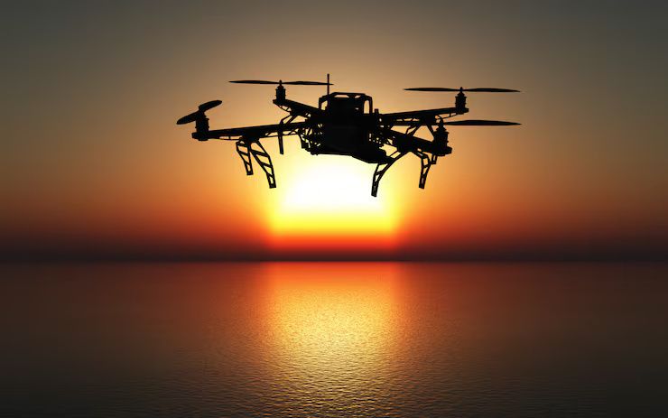
How Drones Work
A typical drone uses several interconnected systems:
- A flight controller receives information from onboard sensors.
- Navigation systems determine the aircraft's position and movement.
- The flight controller calculates required adjustments.
- Motors and propulsion components respond to those commands.
- Communication systems exchange information with the ground controller.
- Cameras or other payloads collect application-specific data.
This feedback process allows the aircraft to maintain stability and follow defined flight instructions.
Major Types of Drones
Different drone configurations are designed for different operating requirements.
| Drone Type | Main Characteristic | Typical Applications |
|---|---|---|
| Multirotor | Multiple vertically oriented rotors | Inspection and photography |
| Fixed-Wing | Efficient forward flight | Mapping and surveying |
| Hybrid VTOL | Vertical takeoff with fixed-wing flight | Long-distance surveying |
| Single-Rotor | Rotor-based lift | Specialized aerial operations |
| Nano Drone | Very small form factor | Indoor inspection and research |
| Heavy-Lift Drone | Higher payload capacity | Industrial logistics research |
Multirotor Drones
Multirotor drones use several rotors to generate lift and control movement. Quadcopters, hexacopters, and octocopters are common configurations.
They can hover and maneuver in relatively confined areas, making them suitable for photography, inspection, mapping, and surveying.
Fixed-Wing Drones
Fixed-wing aircraft generate lift through forward movement rather than relying entirely on vertical rotors.
They can be useful for covering large geographic areas during mapping, agricultural assessment, and environmental surveys.
Hybrid VTOL Drones
Vertical-takeoff-and-landing aircraft combine characteristics of multirotor and fixed-wing designs. They can take off vertically and transition into forward flight.
This configuration can be useful where both localized takeoff and extended-area coverage are required.
Components
Flight Controller
The flight controller is the central processing component responsible for interpreting sensor information and managing aircraft movement.
It receives information from inertial sensors, navigation systems, and other components before sending control commands to the propulsion system.
Motors and Propellers
Electric motors provide the rotational force required to turn propellers. Motor selection depends on aircraft mass, propeller characteristics, battery voltage, desired flight behavior, and payload.
Propeller size and configuration also affect thrust, efficiency, noise, and handling characteristics.
Electronic Speed Controllers
Electronic Speed Controllers regulate motor speed according to commands from the flight controller.
In multirotor systems, coordinated changes in motor speed allow the aircraft to roll, pitch, yaw, ascend, and descend.
Batteries
Lithium-based battery systems are commonly used in electric drones because they provide substantial energy relative to their mass.
Battery capacity, voltage, discharge characteristics, temperature, and payload weight influence flight duration.
Navigation Systems
Navigation can combine satellite positioning, inertial measurement, barometric altitude sensing, visual systems, and other technologies.
Modern drones may use GPS or other satellite-navigation systems alongside onboard sensors to estimate position and movement.
Cameras and Payloads
The payload is the equipment carried for a specific application. Common payloads include:
- RGB cameras
- Thermal cameras
- Multispectral cameras
- LiDAR sensors
- Surveying equipment
- Environmental sensors
- Mapping systems
Payload weight and power requirements affect the aircraft's flight characteristics.
Importance
Why Drone Technology Matters
Drones can collect information from locations that may be difficult, expensive, or hazardous for conventional inspection teams to access.
Aerial data can provide visual information about large areas, structures, terrain, vegetation, and infrastructure while reducing the need for personnel to physically reach every inspection point.
Surveying and Mapping
Surveying drones can collect aerial imagery and geographic data for mapping applications.
Photogrammetry software can combine overlapping images to create orthomosaics, three-dimensional models, elevation information, and other geographic outputs.
Infrastructure Inspection
Drones can inspect bridges, towers, roofs, pipelines, solar installations, wind turbines, and other infrastructure.
High-resolution cameras can capture detailed images, while thermal or other specialized sensors can provide additional information.
Agriculture
Agricultural drones can collect information about crop condition, vegetation patterns, irrigation, and field variability.
Multispectral and thermal sensors can provide information that differs from conventional RGB photography.
Construction
Construction teams can use drones for site documentation, surveying, progress monitoring, terrain mapping, and project visualization.
Repeated flights can create a historical record of site conditions over different stages of development.
Environmental Monitoring
Drones can collect aerial data for vegetation assessment, habitat monitoring, erosion studies, water-body observation, and other environmental applications.
The appropriate payload depends on the characteristics being measured.
Flight Systems
Flight Control
Flight-control systems maintain aircraft stability by continuously processing information from onboard sensors.
Gyroscopes and accelerometers are commonly used to measure changes in orientation and movement.
Navigation and Positioning
Satellite navigation can provide position information for outdoor operations. Inertial measurement systems can supplement navigation information when satellite signals are unavailable or unreliable.
Visual positioning technologies can also assist some drones during indoor or GPS-limited operations.
Obstacle Detection
Some modern drones incorporate cameras, radar, LiDAR, ultrasonic sensors, or other technologies to detect nearby objects.
Obstacle-detection capabilities vary substantially between aircraft and should not be treated as a substitute for appropriate flight planning and operator awareness.
Communication Systems
The aircraft communicates with a ground controller through a wireless link.
Communication systems can transmit control commands, telemetry, video, and other data. Range and reliability depend on the technology, environment, interference, antenna configuration, and regulatory limits.
Autonomous Flight
Autonomous flight systems can follow predefined routes, maintain altitude, return to a designated location, or perform other programmed functions.
Autonomous capabilities depend on the aircraft's software, sensors, navigation system, and operating environment.
Manufacturers and Technology Ecosystem
The drone industry includes manufacturers of aircraft, propulsion components, cameras, navigation systems, batteries, flight controllers, communication equipment, and specialized payloads.
When evaluating drone manufacturers or commercial platforms, organizations can examine:
- Aircraft configuration
- Maximum supported payload
- Flight duration
- Navigation capabilities
- Sensor compatibility
- Communication architecture
- Data-storage options
- Environmental operating range
- Software ecosystem
- Maintenance requirements
- Regulatory compatibility
For commercial applications, the aircraft should be evaluated together with its payload, software, data-processing workflow, and operating requirements.
Commercial Applications
Industrial Inspection
Industrial organizations use drones to collect imagery and sensor data from infrastructure such as pipelines, storage tanks, towers, roofs, power lines, and large industrial facilities.
The collected information can support inspection teams by providing aerial observations and identifying areas that may require closer examination.
Energy Infrastructure
Solar farms, wind turbines, transmission infrastructure, and other energy assets can be surveyed using drones.
Thermal cameras can identify temperature variations in selected applications, while high-resolution imaging can document physical conditions.
Mining and Quarrying
Mining operations can use fixed-wing and multirotor drones for terrain mapping, stockpile measurement, site documentation, and surveying.
Repeated aerial surveys can provide data for comparing changes in terrain and material volumes.
Real Estate and Construction
Aerial photography and mapping can provide visual documentation of buildings, construction sites, land areas, and surrounding infrastructure.
Construction teams can also compare aerial datasets collected at different project stages.
Agriculture
Drones can capture field imagery and multispectral information to support crop monitoring and agricultural analysis.
Data-processing software can identify vegetation patterns and generate maps for further evaluation.
Logistics Research
Drone logistics technology is being developed and tested for selected delivery applications.
Practical implementation depends on aircraft capability, payload, route requirements, airspace regulations, safety procedures, and local authorization.
Recent Updates
AI-Assisted Image Analysis
Artificial intelligence can process aerial imagery to identify objects, classify areas, detect selected visual patterns, and organize large datasets.
Applications can include infrastructure inspection, agricultural analysis, mapping, and construction documentation.
Advanced Imaging
Drone payloads increasingly include thermal, multispectral, hyperspectral, and LiDAR technologies.
These sensors allow drones to collect information beyond conventional visible-light photography.
Improved Navigation
Modern flight systems increasingly combine satellite positioning, inertial sensors, visual navigation, and other positioning technologies.
Multi-sensor approaches can improve navigation robustness in environments where one positioning method may be limited.
Drone-in-a-Box Systems
Automated drone stations, sometimes described as drone-in-a-box systems, combine a drone with a docking station, charging system, communications equipment, and software.
These systems are being developed for recurring inspection and monitoring applications.
Battery and Propulsion Development
Research into battery chemistry, electric motors, power electronics, and energy-management systems continues to influence drone endurance and payload capabilities.
Actual flight duration remains dependent on aircraft configuration, weather, payload, and operating conditions.
Remote Operations
Connected drone platforms can transmit imagery and telemetry to remote operators or centralized systems.
This can support applications where personnel need to monitor operations from a different location, subject to communications and regulatory requirements.
Laws or Policies
Aviation Regulations
Drone operations are governed by aviation regulations that vary by jurisdiction. Requirements can cover aircraft registration, pilot qualifications, operational categories, altitude limits, restricted airspace, identification systems, and permissions.
Commercial operators should verify current rules with the relevant aviation authority before conducting flights.
Privacy
Drone cameras can capture information about people, buildings, vehicles, and private property. Operators should consider applicable privacy and data-protection requirements when collecting or storing imagery.
Airspace Restrictions
Airports, military installations, government facilities, critical infrastructure, and other locations may have restrictions on drone operations.
Operators should check current airspace information before each flight.
Operational Safety
Commercial drone programs generally require documented procedures for flight planning, equipment inspection, battery management, weather assessment, emergency procedures, and incident reporting.
The precise requirements depend on the jurisdiction and operating category.
Tools and Resources
Flight Planning Software
Flight-planning platforms can help operators define routes, altitude parameters, mapping grids, and mission areas.
Photogrammetry Software
Photogrammetry applications can transform overlapping aerial photographs into maps and three-dimensional models.
Geographic Information Systems
GIS platforms can combine drone-derived datasets with geographic information such as property boundaries, infrastructure layers, terrain data, and environmental information.
Fleet Management Platforms
Fleet-management systems can track aircraft, batteries, flight records, maintenance information, and mission history.
Remote Identification
Some jurisdictions require or support remote-identification technologies that transmit information about an unmanned aircraft during flight.
Operators should verify the specific requirements applicable to their aircraft and operating location.
FAQs
What is drone technology?
Drone technology combines unmanned aircraft with flight-control systems, navigation, propulsion, communication equipment, sensors, and application-specific payloads.
What are the main types of drones?
Common categories include multirotor, fixed-wing, hybrid VTOL, single-rotor, small-format, and heavy-lift configurations. Each has different flight characteristics and application requirements.
What are drones used for commercially?
Commercial applications include surveying, mapping, infrastructure inspection, agriculture, construction monitoring, environmental observation, energy-asset inspection, photography, and selected logistics research.
What components are inside a drone?
Major components can include a flight controller, motors, propellers, electronic speed controllers, battery, navigation sensors, communication equipment, and application-specific payloads.
How is AI used in drone systems?
AI can assist with image analysis, object recognition, route planning, anomaly detection, mapping, and large-scale aerial-data processing. Its capabilities depend on the aircraft and software environment.
Conclusion
Drone technology combines aircraft engineering, electronics, software, navigation, communication, sensors, and data-processing systems. Multirotor, fixed-wing, and hybrid aircraft provide different capabilities for applications ranging from infrastructure inspection and surveying to agriculture, construction, environmental monitoring, and industrial data collection.
Developments in AI-assisted analysis, advanced imaging, autonomous navigation, automated docking stations, improved propulsion, and connected operations are expanding commercial drone capabilities. Successful deployment requires matching the aircraft and payload to the application while following applicable aviation, privacy, airspace, and operational-safety requirements.